Via delle Abbazie
White roads climbing toward a cloister. A secular pilgrimage on a gravel bike, ridden slowly.
Official opening 2027An amateur, non-profit project. The tracks are indicative: everyone rides independently, at their own risk.
The Project
You leave the Alps with a loaded bike and arrive at Montecassino, where Saint Benedict founded his abbey around 529. In between lie weeks of climbs and silence. Via delle Abbazie is a secular pilgrimage by bike, open like the Camino de Santiago to believers and to anyone who brings only curiosity. You ride with no stopwatch, from one cloister to the next.
Twenty-nine places of prayer mark the route, abbeys and hermitages. You stop for a stamp and a few minutes in the shade of a portico. Between one stop and the next run white roads and Apennine passes, made for gravel riding and bikepacking. The official opening is planned for 2027.

Three routes, one destination
Three bike routes run down Italy from north to south. The Ponente starts at Mater Ecclesiae, on Lake Orta; the Centro at Chiaravalle, on the edge of Milan; the Levante at Novacella, or at Rosazzo with the Ingresso Adriatico variant, which rejoins it at Praglia. All of them climb the same mountain, up to Montecassino Abbey.
Ponente Route
19 stages · ~1,701 km · ~18,820 m elevation
From Piedmont it drops to the Ligurian sea, then cuts across Tuscany to Montecassino. Vineyards on the hills, and the cool shade of the Casentino forests.
See the 19 stages →Centro Route
16 stages · ~1,306 km · ~20,370 m elevation
It starts in Milan, or in Brescia with the Variante Bresciana. It climbs the Emilian Apennines and crosses the Casentino Forests, then Umbria, all the way to Montecassino.
See the 16 stages →Levante Route
20 stages · ~1,451 km · ~14,520 m elevation
It starts at Novacella, in South Tyrol, or at Rosazzo in Friuli with the Ingresso Adriatico. It crosses the Veneto and follows the sea down to Marche and Abruzzo, then heads for Montecassino. The most paved of the three: flat cycle paths in the north, real climbs in the Apennines.
See the 20 stages →An idea born in the Atacama Desert.
Featured abbeys
 Abbazia di Sant'AntimoRomanesque jewel in the Val d'Orcia.
 Eremo di CamaldoliFounded in 1012 by Saint Romuald.
 Abbazia di NovacellaFounded in 1142 in the Isarco Valley.
Stay updated
Leave your email and we'll tell you about the tracks and the Grand Départ as they take shape. Via delle Abbazie opens in 2027.
Sign up for updatesExplore the pages: All the abbeys · The three routes · Ponente Route · Centro Route · Levante Route
The Three Routes
For each one, stages and climbing, with the track to download before you get in the saddle.
Ponente Route
19 stages · ~1,701 km
From Piedmont, or from the Sacra di San Michele with the Variante Torinese, it drops into Liguria and crosses Tuscany to Montecassino.
See the 19 stages →Centro Route
16 stages · ~1,306 km
From Milan, or from Brescia with the Variante Bresciana, it climbs the Apennines and drops into Umbria, on to Montecassino.
See the 16 stages →Levante Route
20 stages · ~1,451 km
It starts at Novacella, in South Tyrol, or at Rosazzo in Friuli with the Ingresso Adriatico. It crosses the Veneto and follows the sea down to Marche and Abruzzo, then heads for Montecassino. The most paved of the three: flat cycle paths in the north, real climbs in the Apennines.
See the 20 stages →29 abbeys, monasteries and hermitages
The places where the day slows down, in the shade of a cloister after the climb.
The abbeys set the course. In chapter 53 the Rule of Saint Benedict asks that “all guests who present themselves are to be welcomed as Christ”. For centuries that door opened to people who came on foot, tired and dusty, in search of a bed for the night. Today the dust comes from the white roads, and against the cloister wall a bicycle is leaning.
When the doors are open, get off the saddle and have your credential stamped; many abbeys also have a guesthouse for pilgrims.
Montecassino Abbey
Founded in 529 AD by Saint Benedict of Norcia. The cradle of Western monasticism and the final destination of all routes of Via delle Abbazie. Destroyed and rebuilt four times in history, it is the symbol of human spirit's tenacity.
All routes converge here.
Ponente Route
From Piedmont through Liguria and Tuscany to Montecassino
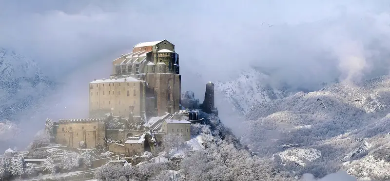 Photo: Elio Pallard · CC BY-SA 4.0
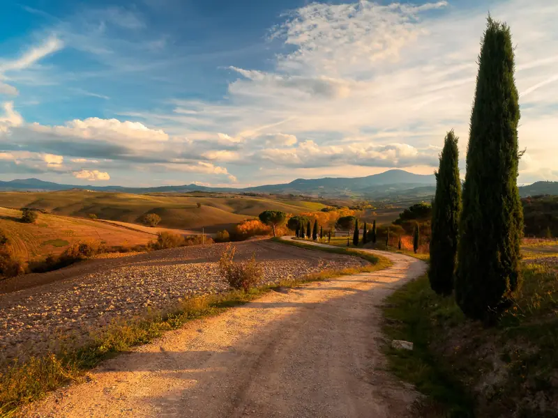 Photo: Fabrizio Lunardi · CC0
Before you set off
Via delle Abbazie is an amateur, non-profit project that aims only to share knowledge: we do not organise trips or offer tourist or guiding services. Anyone who sets off does so independently and entirely at their own risk. The tracks are not waymarked and are still being checked: distances, elevation gain, opening times and availability are indicative and must be checked before you leave. Wild camping is regulated by Italy's regional governments and is often banned in the national and regional parks along the way (Foreste Casentinesi, Monti Sibillini, Monti Simbruini, Gran Sasso, Majella): please use campsites and other places to stay.
The Stages
Centro Route
From Milan (or Brescia, with the Variante Bresciana) through the Emilian Apennines and Umbria to Montecassino
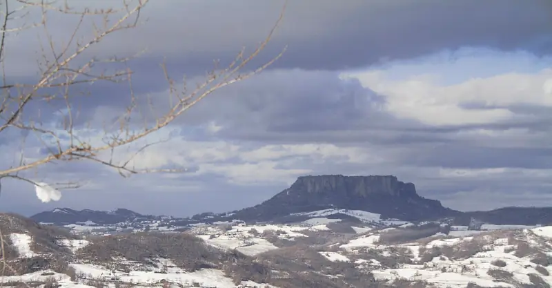 Photo: Oldangia · CC0
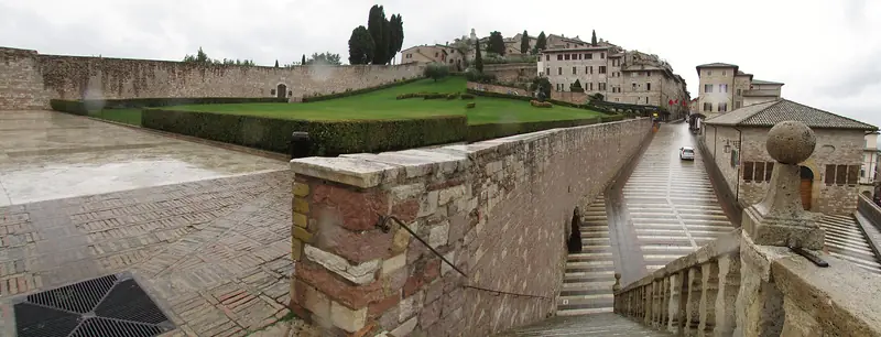 Photo: Chris Light · CC BY-SA 4.0
Before you set off
Via delle Abbazie is an amateur, non-profit project that aims only to share knowledge: we do not organise trips or offer tourist or guiding services. Anyone who sets off does so independently and entirely at their own risk. The tracks are not waymarked and are still being checked: distances, elevation gain, opening times and availability are indicative and must be checked before you leave. Wild camping is regulated by Italy's regional governments and is often banned in the national and regional parks along the way (Foreste Casentinesi, Monti Sibillini, Monti Simbruini, Gran Sasso, Majella): please use campsites and other places to stay.
The Stages
Levante Route
From Novacella (South Tyrol) or Rosazzo (Friuli, Ingresso Adriatico variant) along the Adriatic coast and through Marche and Abruzzo to Montecassino
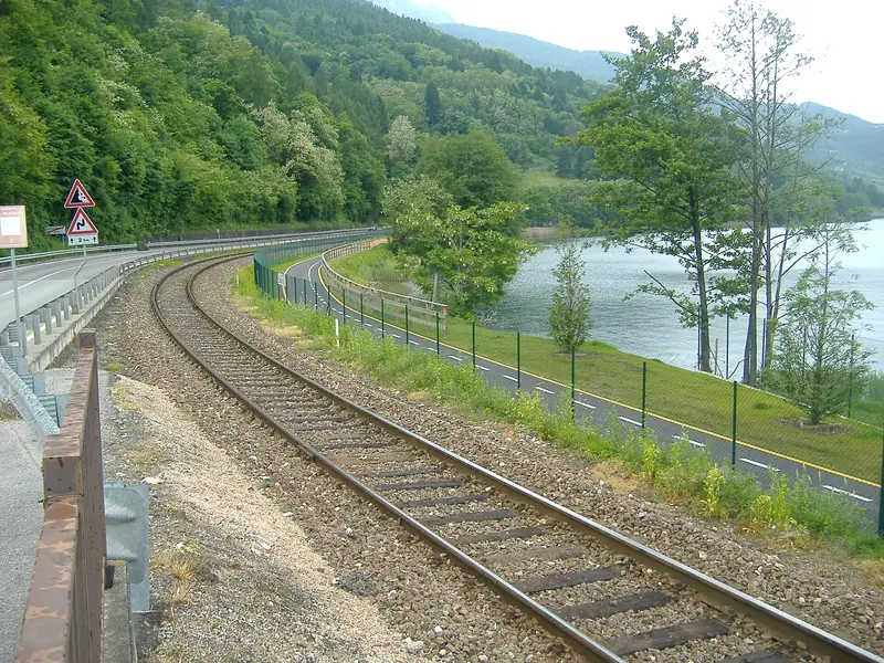 Photo: CristianNX · CC BY-SA 3.0
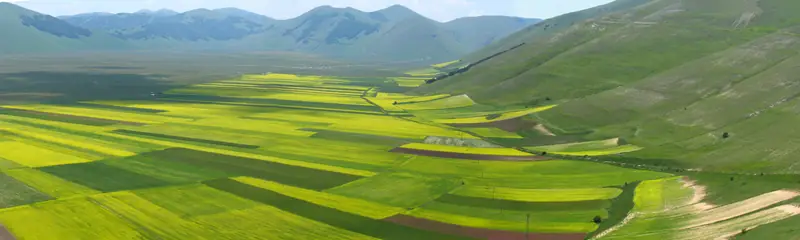 Photo: Peter Forster · CC BY-SA 2.0
Before you set off
Via delle Abbazie is an amateur, non-profit project that aims only to share knowledge: we do not organise trips or offer tourist or guiding services. Anyone who sets off does so independently and entirely at their own risk. The tracks are not waymarked and are still being checked: distances, elevation gain, opening times and availability are indicative and must be checked before you leave. Wild camping is regulated by Italy's regional governments and is often banned in the national and regional parks along the way (Foreste Casentinesi, Monti Sibillini, Monti Simbruini, Gran Sasso, Majella): please use campsites and other places to stay.
The Stages
Interactive Map
The three routes and the abbeys on the map. Pick a colour and follow the line to Montecassino.
Plan Your Journey
What's worth knowing before you load the bike.
Which Route to Choose
Ponente
19 stages · ~1,701 km · ~24 days
Challenging
The longest, with almost 19,000 metres of climbing to ride. In return, the Tuscan hills and the ridges of the Apennines.
Centro
16 stages · ~1,306 km · ~21 days
Moderate-Challenging
The shortest of the three, between the Apennines and Umbria, but the toughest in climbing, with the highest share of gravel on the Via.
Levante
20 stages · ~1,451 km · ~21 days
Moderate
Two starts in the North-East, Novacella in South Tyrol and Rosazzo in Friuli, with the two branches joining at Praglia. Easy cycle paths at first, then hard climbs in Marche and Abruzzo.
Practical Information
When to Depart
The best months run from April to June and from September to October. In summer the centre and south bake, especially Ciociaria and Abruzzo. In autumn the Casentino beech woods and the Umbrian hills change colour.
What Bicycle to Use
We recommend a gravel bike or a touring bike, with tyres of at least 40 mm and 45 as the ideal width. Many sections run on dirt and white roads. The Levante and its Adriatic variant have more tarmac and cycle paths: there a classic touring bike or an e-bike will do.
Where to Sleep
Many abbeys offer a guesthouse for pilgrims, with simple rooms and the community's timetable. Otherwise there are farm stays and B&Bs. On stages without an abbey you sleep in town, always asking for a safe place for the bike.
Estimated Budget
Monastery guesthouses: free offering or 20-40€/night with dinner. B&Bs and farm stays: 50-80€/night. Budget approximately 30-50€/day for meals and small expenses. Total for Centro (~21 days): approximately 1,050-1,850€.
Bike + Train
Every route touches major railway stations or passes close by. The Ponente starts at Mater Ecclesiae, a few kilometres from Orta-Miasino station. The Centro starts at Chiaravalle, a short ride from Milano Rogoredo. The Levante starts at Novacella, on the Isarco valley cycle path, about 3 km from Bressanone/Brixen. The Ingresso Adriatico variant begins on the Alpe-Adria cycle route, easy to reach from Udine station. You can stop the journey and pick it up again from another stop, bike on the train.
Physical Level Required
Everyone rides at their own pace. Planned stages run from about 15 to 135 km, with up to about 1,500 m of climbing. Distances are provisional and the longest days may be split. The Ponente and the Apennines call for good fitness, while the start of the Levante and its Adriatic variant is flat and suits everyone.
What to Bring
Several days in the saddle need little, chosen well. Layered technical clothing and a compact rain jacket, then a repair kit with spare tube, pump and multi-tool. Lights, a lock and a bottle of at least one litre. In the guesthouses a sleeping-bag liner or a light sleeping bag comes in handy. Load the GPX tracks onto your bike computer or phone, and keep the printed credential in your pocket.
Bikepacking and Self-Sufficiency
The Via lends itself to full bikepacking, with a tent and few bookings, relying on places to stay between one abbey and the next. Wild camping is regulated by Italy's regions and often banned in parks. The first 46 overnight options (campsites, guesthouses, hostels, huts) are already on the elevation profiles and maps of each route. For your load we recommend bags on saddle, frame and handlebar. On gravel and white roads heavy panniers spoil the handling, and on a climb every kilo counts.
Important notes
Via delle Abbazie is an amateur, non-profit project. It was born to share the land and the hidden beauty of this country, to be crossed slowly by bike. It offers information and no tourist services: no packages, guides, escorts, luggage transfers or support along the way. The tracks are calculated on real roads and cycle paths (OpenStreetMap) and still need to be checked on the ground; they carry no waymarks, and opening times and availability may change.
Everyone rides entirely at their own risk. Assess your fitness and the condition of your bike, check the weather and traffic, and follow the Italian Highway Code and the rules of the places you pass through. Abbeys and hermitages are places of prayer and home to the communities who live there. Enter quietly, follow their rhythms and silences, respect private property and nature, and leave every place as you found it. Wild camping is regulated by Italy's regions and is often banned in national and regional parks, such as Foreste Casentinesi, Monti Sibillini, Monti Simbruini, Gran Sasso and Majella. For the night, choose campsites and proper places to stay.
Download GPX
One track per route, to load onto your bike computer or phone before you ride off.
Ponente Route
Whole route · 1976 KB Turin Variant (Variante Torinese) (whole variant) · 126 KBTracks of the individual stages (21)
- 1 · Mater Ecclesiae → Bose83 km · 83 KB
- 2 · Bose → Vercelli50 km · 51 KB
- 3 · Vercelli → Staffarda183 km · 164 KB
- 4 · Staffarda → Asti108 km · 102 KB
- 5 · Asti → Tortona72 km · 65 KB
- 6 · Tortona → San Colombano80 km · 103 KB
- 7 · San Colombano → Chiavari109 km · 156 KB
- 8 · Chiavari → S. Croce del Corvo114 km · 134 KB
- 9 · S. Croce del Corvo → Lucca103 km · 102 KB
- 10 · Lucca → Pontassieve102 km · 111 KB
- 11 · Pontassieve → Vallombrosa19 km · 30 KB
- 12 · Vallombrosa → Camaldoli52 km · 73 KB
- 13 · Camaldoli → Arezzo67 km · 76 KB
- 14 · Arezzo → Sant'Antimo98 km · 99 KB
- 15 · Sant'Antimo → Orvieto112 km · 125 KB
- 16 · Orvieto → Farfa136 km · 141 KB
- 17 · Farfa → Subiaco80 km · 97 KB
- 18 · Subiaco → Casamari71 km · 84 KB
- 19 · Casamari → Montecassino62 km · 75 KB
Variant stages: Turin Variant (Variante Torinese)
- V1 · Sacra di San Michele → Torino38 km · 45 KB
- V2 · Torino → Asti73 km · 82 KB
Centro Route
Whole route · 1729 KB Brescia Variant (Variante Bresciana) (whole variant) · 143 KBTracks of the individual stages (18)
- 1 · Chiaravalle → Morimondo36 km · 28 KB
- 2 · Morimondo → Certosa di Pavia33 km · 31 KB
- 3 · Certosa di Pavia → Piacenza81 km · 68 KB
- 4 · Piacenza → San Colombano47 km · 50 KB
- 5 · San Colombano → Borgo Val di Taro97 km · 143 KB
- 6 · Borgo Val di Taro → Bismantova118 km · 165 KB
- 7 · Bismantova → Firenzuola165 km · 228 KB
- 8 · Firenzuola → Vallombrosa92 km · 114 KB
- 9 · Vallombrosa → Camaldoli52 km · 73 KB
- 10 · Camaldoli → Umbertide123 km · 148 KB
- 11 · Umbertide → Assisi58 km · 60 KB
- 12 · Assisi → Spoleto48 km · 54 KB
- 13 · Spoleto → Norcia58 km · 75 KB
- 14 · Norcia → Subiaco165 km · 210 KB
- 15 · Subiaco → Casamari71 km · 84 KB
- 16 · Casamari → Montecassino62 km · 75 KB
Variant stages: Brescia Variant (Variante Bresciana)
- V1 · Rodengo Saiano → Cremona101 km · 107 KB
- V2 · Cremona → Piacenza45 km · 37 KB
Levante Route
Whole route · 1849 KB Adriatic Gateway Variant (Ingresso Adriatico) (whole variant) · 231 KBTracks of the individual stages (24)
- 1 · Novacella → Bolzano47 km · 56 KB
- 2 · Bolzano → Trento68 km · 69 KB
- 3 · Trento → Bassano92 km · 107 KB
- 4 · Bassano → Praglia74 km · 79 KB
- 5 · Praglia → Ferrara110 km · 114 KB
- 6 · Ferrara → Pomposa62 km · 59 KB
- 7 · Pomposa → Ravenna72 km · 56 KB
- 8 · Ravenna → Rimini59 km · 57 KB
- 9 · Rimini → Urbino58 km · 70 KB
- 10 · Urbino → Fonte Avellana43 km · 59 KB
- 11 · Fonte Avellana → Camerino75 km · 85 KB
- 12 · Camerino → Fiastra36 km · 45 KB
- 13 · Fiastra → Ascoli Piceno85 km · 110 KB
- 14 · Ascoli Piceno → L'Aquila104 km · 129 KB
- 15 · L'Aquila → S. Spirito a Majella107 km · 127 KB
- 16 · S. Spirito a Majella → Sulmona62 km · 73 KB
- 17 · Sulmona → Avezzano87 km · 98 KB
- 18 · Avezzano → Subiaco77 km · 90 KB
- 19 · Subiaco → Casamari71 km · 84 KB
- 20 · Casamari → Montecassino62 km · 75 KB
Variant stages: Adriatic Gateway Variant (Ingresso Adriatico)
- V1 · Rosazzo → Udine21 km · 24 KB
- V2 · Udine → Conegliano106 km · 106 KB
- V3 · Conegliano → Treviso33 km · 33 KB
- V4 · Treviso → Praglia82 km · 71 KB
How to use them: Garmin: import the file into Garmin Connect (Courses) or copy it to the Garmin/NewFiles folder of your device. Wahoo: open it with the ELEMNT app and save it as a route. Komoot: upload it at komoot.com/upload and sync the app.
Pilgrim Credential
A folded sheet in your handlebar bag that picks up a stamp at every abbey. Print it before you leave and carry it all the way to Montecassino.
Physical credential and Testimonium: what exists and what is in preparation →
Bicycle Pilgrim Credential
Via delle Abbazie · From the Alps to Montecassino
Bicycle pilgrimage through 29 Italian abbeys, monasteries and hermitages
Pilgrimage Stamps
Have each abbey you visit along the way stamp your credential
Montecassino Abbey
Final destination · Cradle of Western monasticism
Certificate of completion
About us
Why Via delle Abbazie exists
Via delle Abbazie is an amateur, non-profit project. It exists to share, by bike, a land and the beauty you discover by going slowly. There are abbeys and hermitages, and also back roads and villages left off the postcards. We write about them so that those who pass through do so slowly, with respect for the places and for the people who live there. We share what we learn, without selling trips. Everyone sets off in the saddle and at their own risk.
A secular pilgrimage by bike, at your own pace, linking Italy's great monasteries from the Alps to Lazio.
There are three routes, Ponente, Centro and Levante, and the Levante also has a variant, the Ingresso Adriatico, which rejoins it at Praglia. All of them converge on Montecassino Abbey, founded by Saint Benedict around 529. There, according to tradition, the saint wrote his Rule.
Where it can, the Via follows Italy's great cycle routes: the Adige, the Valsugana, the Alpe-Adria, the Po cycle route and the Ciclovia del Sole. Where the protected tarmac ends, the wheels carry on along back roads and historic tracks.
2026 is our year of scouting. At the pace of an amateur project we are defining the routes and testing the stages by bike, on the ground. We have started writing to the abbeys and to places to stay, and for now the published tracks are provisional.
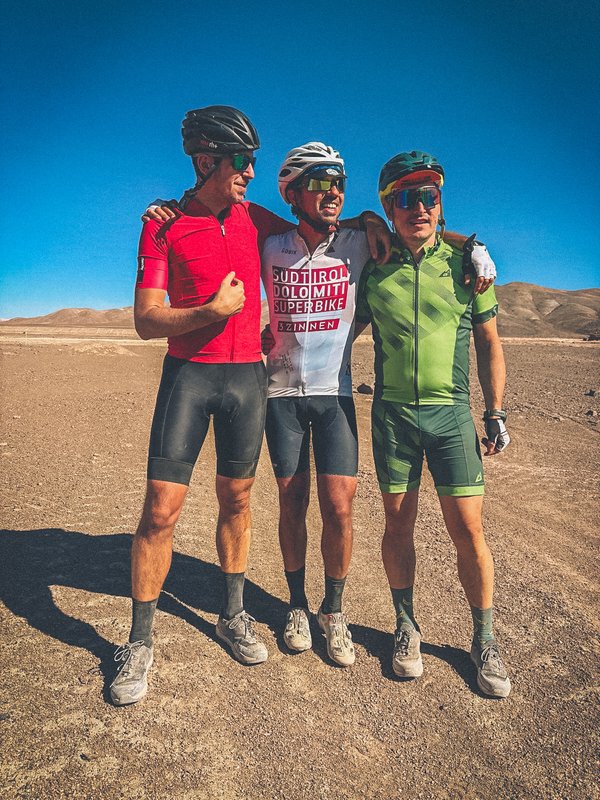
Andrea Bariselli
Creator and project lead
Psychologist and neuroscientist, author and science communicator. At twenty-five he ran a clinical psychology centre, working on chronic pain and neurological disorders. He then took neuroscience outdoors, to study how environments and landscapes act on attention and emotion. For Rizzoli he wrote “A Wild Mind” (2024), which grew out of his podcast of the same name on the brain and nature, and “Unspecial” (2026). He writes the Mantica newsletter and contributes as a reporter to DOVE (Corriere della Sera). He leads expeditions and journeys, from the Atacama Desert to Mongolia.
Claudio Sabatti and Andrea Razio
Travel companions and co-creators
The idea of Via delle Abbazie was born with them, cycling through the Atacama Desert.
Riding in silence: what the research says
After a few hours in the saddle on an open road, the horizon widens and thoughts slow down. Research offers clues, nothing more. According to Rachel and Stephen Kaplan's attention restoration theory, natural settings hold the gaze “softly”. In this way they may help a focus worn down by everyday life. Many studies link regular, moderate aerobic exercise with better mood, and time outdoors with higher perceived well-being. Therapy is something else. Here it is enough to ride slowly, for long enough to make room for your thoughts.
— Andrea Bariselli
This text is not medical advice: if you have health concerns, talk to a professional before you set off.
Beyond Italy
Ideas for the future, still to be mapped
Italy comes first. For 2027 there is one commitment: to complete and check the three routes to Montecassino. Here we keep a few notes for later, great European monastic sites that might one day speak to the Via. They are ideas, still without a track on the ground.
Canterbury
England
The cathedral where Thomas Becket was assassinated. Natural connection heading up the Via Francigena from Rome, passing through Siena, Lucca, the Great Saint Bernard Pass to Canterbury.
Santiago de Compostela
Spain
From the Camino to Finisterre, "the end of the world". From Ponente through the Côte d'Azur and Catalonia, or along the Aragonese Way.
Mont Saint-Michel
France
The island-abbey in the heart of Normandy. Connection through Provence and the Loire Valley, one of the most iconic places of European monasticism.
Meteora Monasteries
Greece
The monasteries suspended on the cliffs of Thessaly. Eastern extension from the Adriatic variant of the Levante through Slovenia, Croatia and the Balkans.
Clonmacnoise
Ireland
The Celtic monastic tradition that "saved civilisation". An Atlantic extension for the more adventurous, toward the roots of European monasticism.
Montserrat
Catalonia
The abbey in the mountain, sacred in Benedictine monasticism. Connection from Ponente through Provence toward Catalonia.
Montecassino is the last stamp on the credential.
The other roads stay pinned on a map, for another journey.
Join the Project
There are four ways to lend a hand.
For Bicycle Pilgrims
Download the GPX files and leave us your email: we'll write when there is news on tracks and abbeys.
For Abbeys
If your community would like to join the Via network, write to us. We'll talk it through together, from hospitality to the credential stamp.
Contact UsFor those who know the area
If you live along the Via or ride it often, you know things the map misses, like a hidden fountain or a mistake in the track. Write to us, and whoever comes after you will find the route clearer.
Send us a reportFor Institutions & Organizations
For signage and cycling infrastructure we are looking for public bodies and institutions to work with, public-private partnerships included. The aim is safer roads for people travelling by bike.
Institutional ProposalStay updated
Leave your email for news on the project and the 2027 Grand Départ. We'll write rarely, only when there is something to tell, and never to sell.